GIS – Airport Fire, Southern California 2024
 Land Surface Temperature Map – Airport Fire, September 15, 2024 (NASA / JPL-Caltech / ECOSTRESS)
Airport Fire – September 15, 2024
NASA’s ECOSTRESS (ECOsystem Spaceborne Thermal Radiometer Experiment on Space Station) recorded thermal imagery of the Airport Fire during its active expansion across Orange and Riverside Counties, Southern California.
At 1:03 AM PST, ECOSTRESS detected land surface temperatures from 62°F (17°C) in unburned regions to 177°F (77°C) in active burn zones, highlighting two intense fire clusters moving under Santa Ana wind conditions.
The Airport Fire ignited on September 9, 2024, due to equipment use during vegetation clearance, and spread rapidly through rugged terrain and dry vegetation. It was fully contained on October 5, 2024, after burning more than 23,526 acres (9,521 ha). ECOSTRESS data provided valuable insights into fire spread, intensity patterns, and thermal behavior for post-event analysis.
This visualization was created by Bill Chen (Arnold O. Beckman High School) in collaboration with Dr. Joshua R. Fisher (Chapman University) and has been published in NASA’s ECOSTRESS Gallery.
Research Image
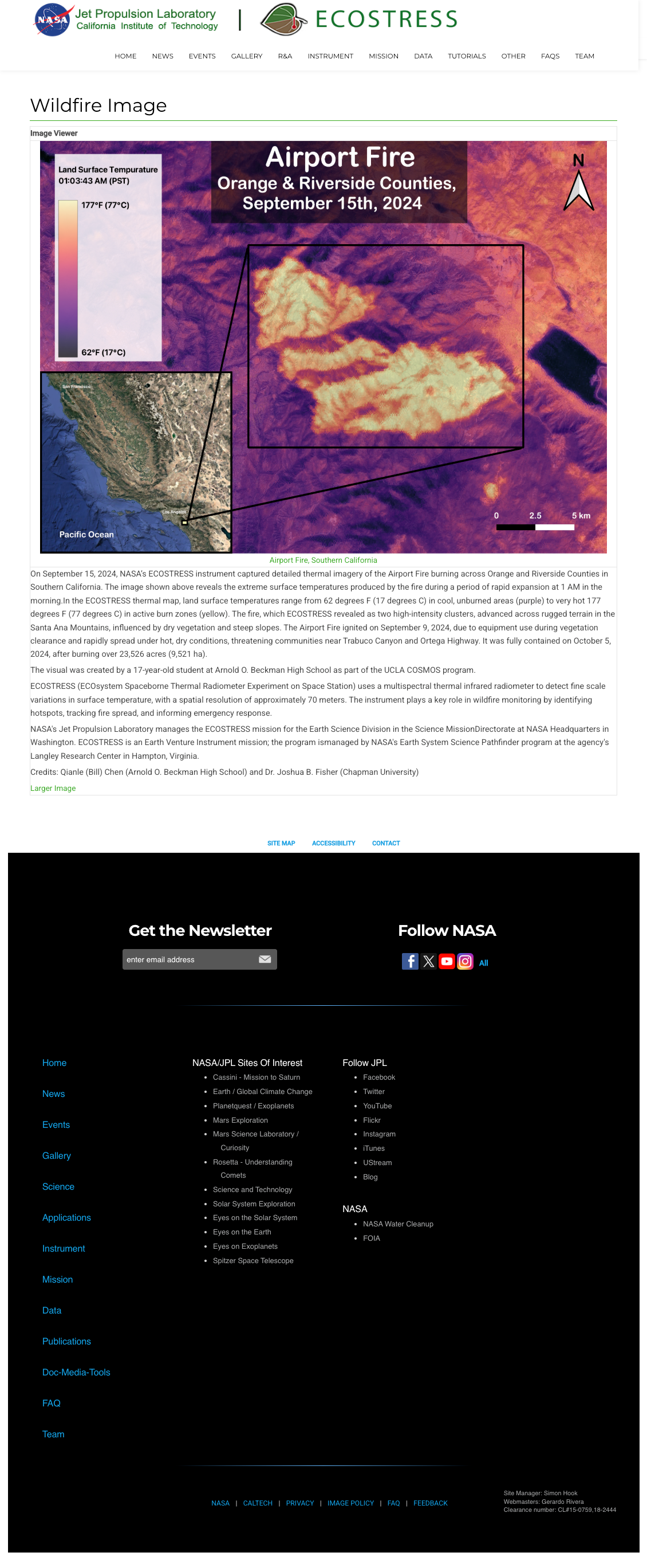
ECOSTRESS thermal map of the Airport Fire across Orange and Riverside Counties, California, on September 15, 2024. Published in NASA ECOSTRESS Gallery. Image credit: NASA / JPL-Caltech / ECOSTRESS.
Credits
Created in collaboration with:
- Bill Chen (Arnold O. Beckman High School)
- Dr. Joshua R. Fisher (Chapman University)