GIS – Silverado Fire, Southern California 2020
 Land Surface Temperature Map – Silverado Fire, October 29, 2020 (NASA / JPL-Caltech / ECOSTRESS)
Silverado Fire – October 29, 2020
NASA’s ECOSTRESS (ECOsystem Spaceborne Thermal Radiometer Experiment on Space Station) captured high-resolution land surface temperature data of the Silverado Fire across Orange County, California.
At 6:21 PM PST, ECOSTRESS recorded temperatures ranging from 68°F (20°C) in unaffected terrain to 176°F (80°C) in the most intense fire zones, revealing multiple high-temperature cores and the fire’s spread through canyon foothills under Santa Ana wind conditions.
The Silverado Fire began on October 26, 2020, and was fully contained by November 7 after burning more than 12,466 acres (5,046 ha). ECOSTRESS imagery provided valuable insight for emergency coordination and scientific analysis of fire behavior, drought stress, and post-fire recovery.
The visualization was created by Bill Chen (Arnold O. Beckman High School) in collaboration with Dr. Joshua R. Fisher (Chapman University) and has been published in NASA’s ECOSTRESS Gallery.
Research Image
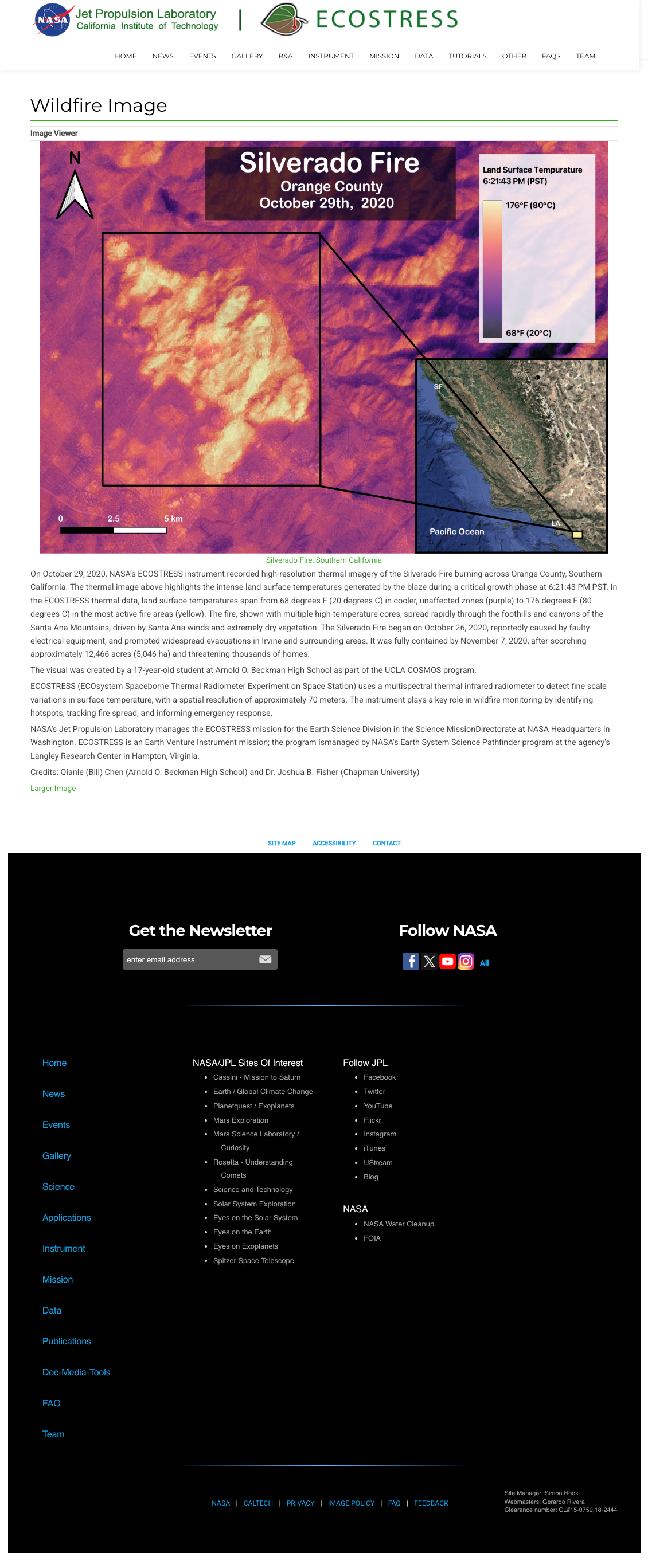
ECOSTRESS thermal map of the Silverado Fire in Orange County, California, on October 29, 2020. Published in NASA ECOSTRESS Gallery. Image credit: NASA / JPL-Caltech / ECOSTRESS.
Credits
Created in collaboration with:
- Bill Chen (Arnold O. Beckman High School)
- Dr. Joshua R. Fisher (Chapman University)