GIS – Serabigões Wildfire, Northern Portugal 2025
 Serabigões Fire Heat Map – Portugal, July 29, 2025 (NASA / JPL-Caltech / ECOSTRESS)
Serabigões Wildfire – July 29, 2025
NASA’s ECOSTRESS (ECOsystem Spaceborne Thermal Radiometer Experiment on Space Station) recorded high-resolution thermal data of the Serabigões fire front in northern Portugal.
The thermal map captured land surface temperatures from 26.7°C (80°F) to 96.7°C (206°F), identifying multiple active burn zones during a critical afternoon period under extreme heat and dry conditions.
This segment of the Severe Fire Complex affected rural areas around Serabigões and surrounding hills, continuing through late July. The dataset supports fire behavior analysis, damage assessment, and emergency response coordination.
The visualization was created in collaboration with Dr. Joshua R. Fisher (Chapman University) and Bill Chen (Arnold O. Beckman High School) and has been published in the NASA ECOSTRESS Gallery.
Research Image
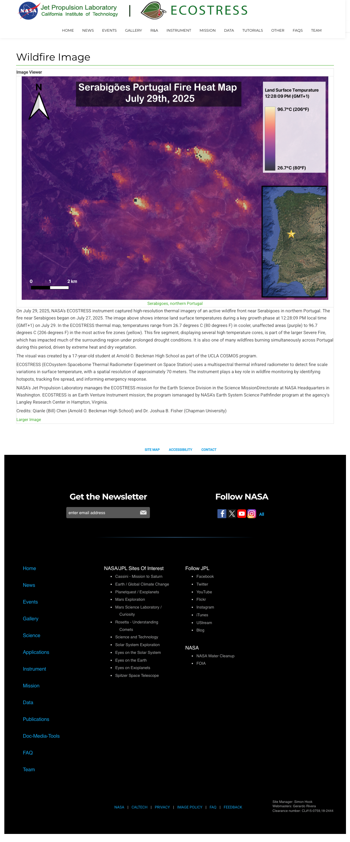
ECOSTRESS thermal imagery showing active fire zones near Serabigões, northern Portugal, on July 29, 2025. Published in NASA ECOSTRESS Gallery. Image credit: NASA / JPL-Caltech / ECOSTRESS.
Credits
Created in collaboration with:
- Bill Chen (Arnold O. Beckman High School)
- Dr. Joshua R. Fisher (Chapman University)