GIS – Portugal Wildfires 2025
 Land Surface Temperature Map – Portugal Wildfires, July 29, 2025 (NASA / JPL-Caltech / ECOSTRESS)
Portugal Wildfires – July 29, 2025
NASA’s ECOSTRESS (ECOsystem Spaceborne Thermal Radiometer Experiment on Space Station) recorded thermal anomalies during the 2025 Portugal wildfires.
The dataset shows land surface temperatures exceeding 111°C (242°F) across multiple fronts in the northern region. These measurements provided key insights into fire intensity, spread, and local impacts, supporting environmental monitoring and emergency response.
This visualization was produced in collaboration with Dr. Joshua Fisher (Chapman University), and has been published in the NASA ECOSTRESS Gallery for public access.
Research Image
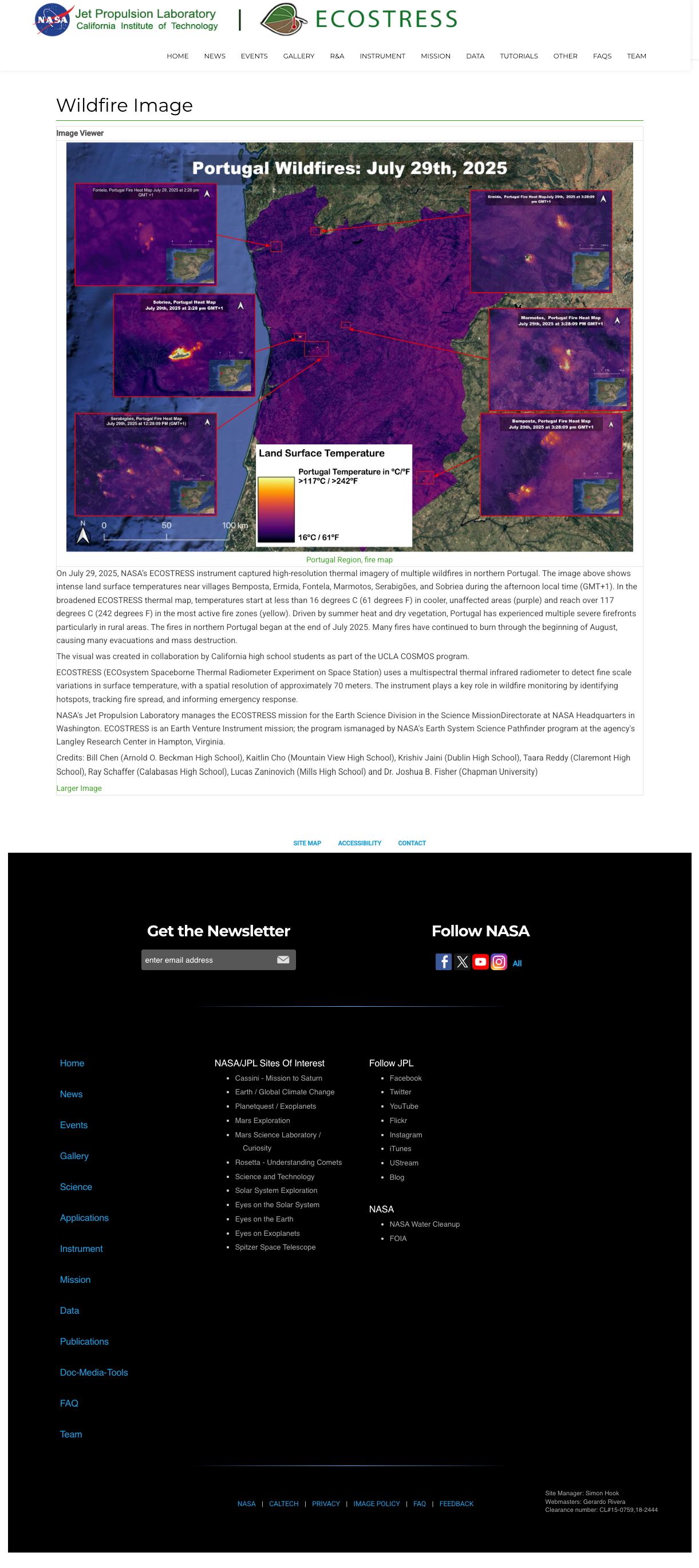
ECOSTRESS thermal imagery showing multiple active fire zones in Portugal on July 29, 2025. Visualization published on NASA ECOSTRESS Gallery. Image credit: NASA / JPL-Caltech / ECOSTRESS.
Credits
Created in collaboration with:
- Bill Chen (Arnold O. Beckman High School)
- Dr. Joshua R. Fisher (Chapman University)